Biosecurity New Zealand has updated the legal controls for parts of the upper North Island to help prevent the spread of exotic caulerpa seaweed. There are now two categories of controls that should be easier to understand and most importantly, continue to help prevent the spread of exotic caulerpaigning these new CANs, we’ve worked with partners, stakeholders and communities, considering feedback from meetings and an online survey.
There are now two categories of controls that should be easier to understand and most importantly, continue to help prevent the spread of exotic caulerpa.
Yellow zones
These mapped zones cover most of the areas under controls. In these zones the following are allowed:
Anchoring - however, before moving location, you must check your anchor and chain. Any seaweed found must be stored safely on a vessel and disposed of onshore – known as “Bag It Bin It.”
line fishing with a rod or handline from the shore
fishing from an anchored boat
drift fishing, spear fishing and hand gathering
potting (crab and crayfish).
After fishing or diving, your gear must be thoroughly checked and cleaned before moving location and any seaweed found is bagged and binned.
In yellow zones, fishing methods that disturb the seabed are not allowed, including:
bottom trawling
dredging
flounder netting.
Red zones
These are higher-risk zones where there is high-density exotic caulerpa present, or the area has high ecological or cultural value.
There are tighter controls in these areas, and the following are not allowed:
Anchoring - except in an emergency or with a permit in exceptional circumstances from Biosecurity New Zealand.
Fishing activities that make contact with the seabed:
trawling
dredging
flounder netting
crab/cray potting.
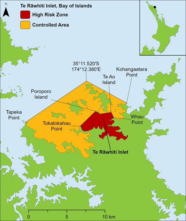
In the Te Rāwhiti Inlet red zone, no fishing is allowed at all.
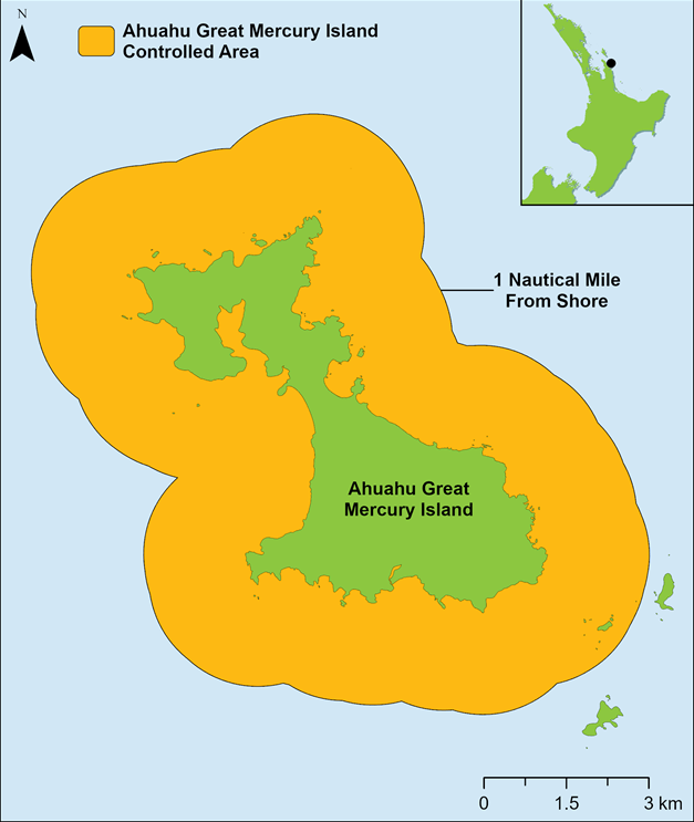
Some changes have also been made to the boundaries of some of the five areas under legal controls (see maps below). Where CANs have been extended, the lighter 'yellow' rules apply.
Full information about the new CANs is on the MPI website.
Maps of new Controlled Areas
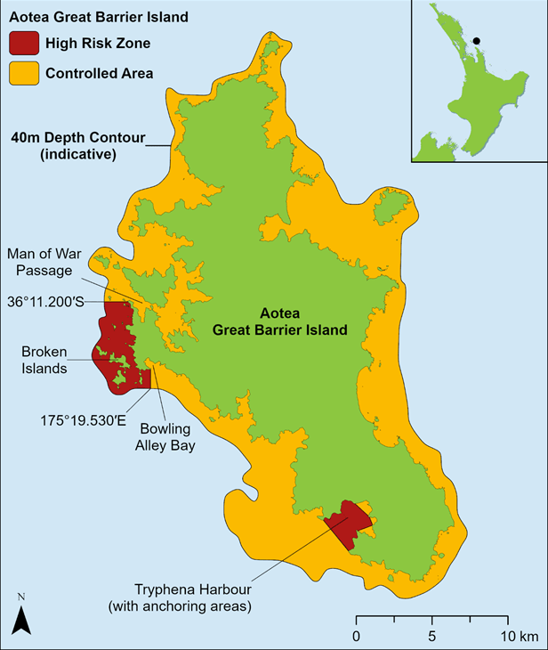
Aotea Great Barrier Island
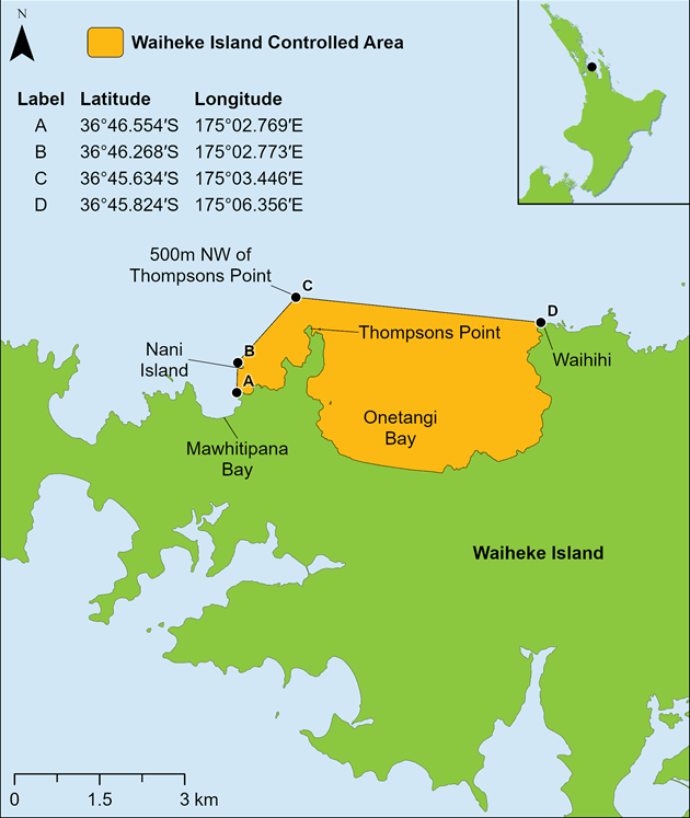
Waiheke Island
Te Rāwhiti, Northland
Ahuahu Great Mercury Island
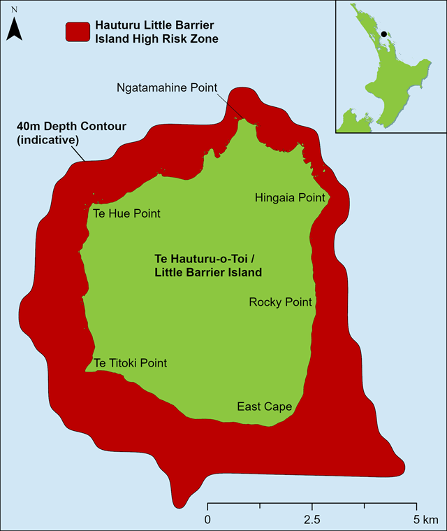
Hauturu-o-Toi Little Barrier Island